Tom Swarbrick 4pm - 7pm
2 October 2020, 15:19

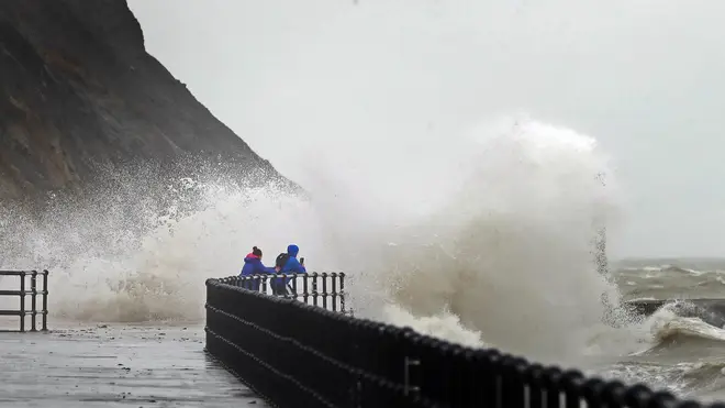
Weather warnings are in place across most of the UK this weekend as Storm Alex hits with gale-force winds and torrential rain.
Winds of up to 61mph are currently battering the South West as the storm moves in from France, but this is expected to subside by the end of Friday - leaving rain warnings in place for the following 48 hours.
Amber warnings are in place until 6pm on Sunday for parts of Wales, the West Midlands and south-west England, where travel disruption is most likely.
Further yellow rain warnings are in place for the majority of the remaining parts of the UK, also for the weekend.
⚠️ Yellow Warning updated ⚠️
— Met Office (@metoffice) October 2, 2020
Rain across much of the UK
Saturday 0300 – Sunday 1200
Latest info 👉 https://t.co/QwDLMfRBfs
Stay #WeatherAware pic.twitter.com/cZOooVHUOg
The storm has already caused travel chaos and disrupted power lines in the South West and in the Isle of Wight, with breakdown cover provider Green Flag predicting more to come.
It has estimated to see around nine breakdowns per minute across the country between Friday and Monday, with a 10% increase in callouts expected tomorrow.
Green Flag commercial director Mark Newberry urged caution among motorists as he noted that Saturday would likely be the busiest day for breakdowns.
He said: "As a result of these weather conditions, we urge drivers to remain cautious and to carry out the relevant safety checks before leaving to make their journeys."
Meanwhile, Western Power Distribution recorded a a number of incidents on Friday in Devon, Cornwall, Dorset and Somerset.
Energy Networks Association, the national industry body for gas and electricity, said there was no "significant disruption" from the storm, but added that it was monitoring conditions "very closely".
Further rain to come across many southern areas this afternoon, this heavy at times and feeling cool 🌧️. As #StormAlex pulls away, winds will ease for many but gales or severe gales continuing in the far southwest 💨🍂
— Met Office (@metoffice) October 2, 2020
Northern areas will be much drier, calmer and sunnier ☀️ pic.twitter.com/THzvP8rf6G
According to Met Office spokeswoman Nicola Maxey, the highest wind speed of 61pmh hit Berry Head in Devon and the Isle of Wight on Friday morning.
She stressed this could leave power lines "susceptible to damage" especially as it is early autumn, when leaves are still on the trees and can result in branches being more likely to fall in high winds.
Turning to the outlook for the rest of the weekend, she added: "A second rain front is coming to replace Storm Alex over the weekend, pushing in from the east on Saturday morning and affecting western areas later on.
"The rain is slowly pushing north but it will be relieved as it goes.
"On Saturday, most of the country will be affected by rain, and it's looking heaviest in the centre, down the spine of the country from Aberdeen to Bristol."
Autumnal temperatures are also to be expected, with forecasts of around 10-15C - and the cooler end of the scale to be felt in Scotland.