Tom Swarbrick 4pm - 7pm
29 February 2020, 11:51

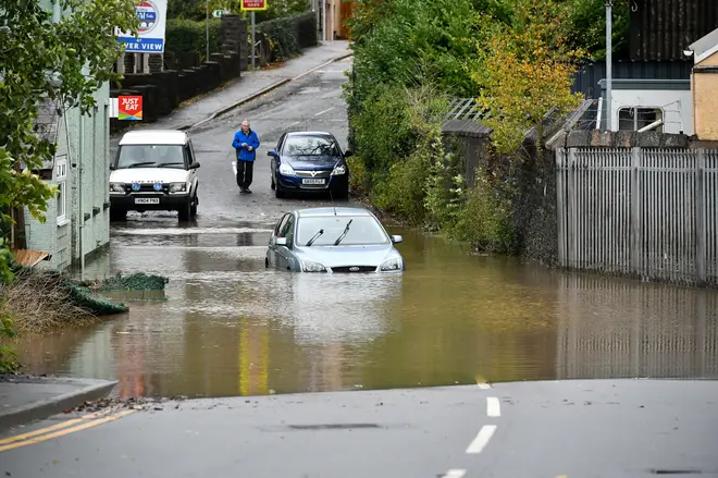
South Wales Police have stood down a "critical incident" that was put in place overnight, however heavy rain and strong winds are still expected to batter the UK.
The force said: "The critical incident declared following flooding and severe weather related incidents has now been stood down.
"The public can be reassured that agencies continue to work together and everything is still being done to ensure their safety and emergency services are coping with the pressure placed upon them.
"The situation will be monitored throughout the day and agencies remain prepared if further issues arise."
Superintendent Andy Kingdom said: "Indications are that the rain is set to stop and river levels will soon recede.
"There is still significant surface water and debris on the roads throughout the force area so we would advise people only to travel if absolutely necessary."
Areas badly hit included Pontypridd, which was also flooded two weeks ago, and the Ely area of Cardiff.
Wales is braced for further wind and rain on Saturday.
There were six yellow weather warnings for rain, wind and snow in force across the country on Saturday morning, stretching from Cornwall to the north of Scotland and across to Northern Ireland.
A total of 83 flood warnings were in place across England and Wales, mostly in the South West and along the English-Welsh border, and in Yorkshire, while a further 211 "flooding is possible" alerts are also in force.
Almost everywhere saw rain on Friday, and sunshine was in short supply pic.twitter.com/dDZXLqBKAi
— Met Office (@metoffice) February 28, 2020
Forecaster Emma Salter from the Met Office said rain was expected to continue until about 11am, before sunshine dominated through the middle of the day.
Snow would continue to fall, especially in the Scottish Highlands, where Ms Salter said up to 30cm was predicted in some places.
The wind was also expected to be a factor, with gusts up to 75mph expected in more exposed places in northern England and the Highlands.
Ms Salter said the Met Office encouraged people to "slow down, plan ahead and look out for each other" during the cold and stormy weather.
Strong winds are forecast for much of England, Wales and Northern Ireland on Saturday, reaching 70mph in coastal areas and up to 60mph inland.
This month is already the second wettest February on record, with the total average rainfall from February 1 to 25 measuring 179.3mm, the Met Office said.The figure to beat is 193.4mm, which was set in February 1990.
Storm Jorge is the fifth storm to hit the UK since December 6 last year and third in February.
Met Office forecaster Craig Snell said it was "not uncommon" to see so many storms in such a short period of time.
We’ve experienced heavy rain in some parts of England and there is a high risk of rivers flooding.
— Environment Agency (@EnvAgency) February 28, 2020
Check your local flood risk: https://t.co/N1tiB9aIDI#Floods #Flooding #PrepareActSurvive pic.twitter.com/sXW0eE60Ch
Public Advice for people in affected areas is as follows:
• Remain indoors, unless your journey is absolutely necessary.
• Steer well clear of dangers such as waterways.
• In an emergency, dial 999 – let highly skilled emergency service and rescue staff deal with incidents safely.
• Monitor local media and social media accounts for relevant organisations for updates.