Nick Ferrari 7am - 10am
20 January 2024, 13:27 | Updated: 20 January 2024, 13:47

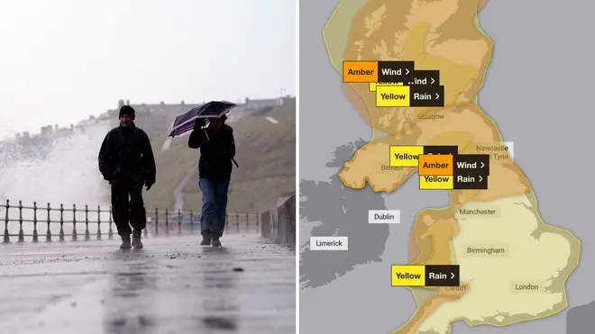
Storm Isha is set to bring winds of up to 80mph and heavy rain throughout the next week - but which areas will be it the hardest?
Strong winds and torrential rain are set to batter Britain this weekend, with the worst set to arrive on Sunday.
Scotland will be the first to be hit by Storm Isha, with rain warnings in place from 5pm on Saturday.
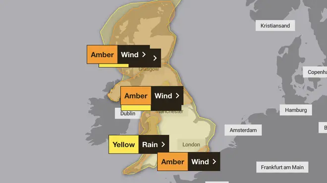
Forecasters also issued a fresh 'danger to life' warning for Sunday and heading into Monday - the third amber alert in place due to the storm.
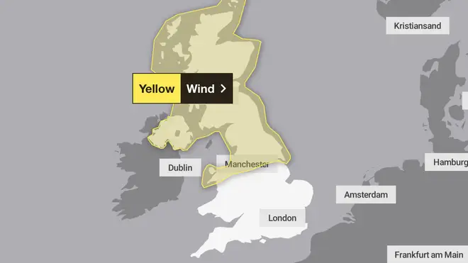
The windy weather will continue into next week, with warnings covering Northern Ireland, north Wales, northern England and much of Scotland in place across Tuesday and Wednesday.

Travel disruption, power cuts, damage to buildings and large waves are expected, the Met Office said.
East Midlands Railway said it expected "significant disruption" on Sunday and Monday and delays and alterations to services, while Police Scotland advised people to avoid unnecessary travel.
Read more: Former soap actress, 96, dies after being hit by delivery van
⚠️⚠️ Amber weather warning issued ⚠️⚠️
— Met Office (@metoffice) January 20, 2024
Very strong winds across parts of northern and central Scotland
Sunday 2100 – Monday 0900
Latest info 👉https://t.co/QwDLMfRBfs
Stay #WeatherAware ⚠️ pic.twitter.com/c5qTNeqDGl
Gusts of 45-55mph are likely inland, but there is the potential for 60-70mph winds in a few places. Coastal areas could even see winds of 80mph.
Locals have been warned that there is a risk of injuries from large waves and beach material being thrown onto sea fronts and properties.

The heaviest downpours are expected during Sunday as 30-50mm could fall in many places and there is potential for peaks of 80-100mm over hills.
Heavy rain could also lead to flooding and transport disruption on Sunday in Scotland, Wales and north-west England.
As of Saturday afternoon, the Environment Agency had eight flood warnings and 52 flood alerts in place.
Storm Isha will bring damaging gusts of wind and heavy rain to much of the UK through Sunday and into Monday ⚠️
— Met Office (@metoffice) January 20, 2024
Here is an update with Meteorologist @GregDewhurst pic.twitter.com/kcPw4831zD
Despite the stormy weather, warmer temperatures will replace the recent snow and sub-zero chills, with highs of 12C possible on Sunday.
Met Office meteorologist Alex Burkill, said "temperatures are going to be much higher than they have been" over the weekend.
"Quite widely we could see places reaching highs of 12C-13C but we need to factor in the strong winds, the rain, the cloud, and so it is not going to feel quite so warm as this might suggest," he said.
He added: "Temperatures will be on the mild side, lifting as we go through this weekend and staying mild through much of next week.
"There may be some chillier spells but I think that any frost is likely to be isolated if we see any at all.
"There could be some overnight fog, particularly where we see drier calmer weather towards the South East."