
Ian Payne 4am - 7am
16 January 2023, 10:13 | Updated: 16 January 2023, 10:52
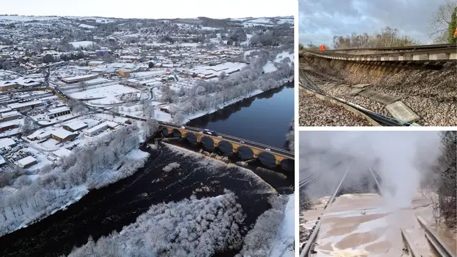
Parts of Britain were blanketed by snow this morning after an Arctic blast swept the country, with freezing temperatures as low as -10C predicted.
There was also misery for commuters with the Met office warning of treacherous conditions on roads with swathes of the country under yellow weather warnings.
Rail passengers have been warned not to travel on some services in and out of London after a long section of a main rail line collapsed.

A 44-metre section of track collapsed near Hook station in Hampshire, on the line from London to Basingstoke over the weekend.
⚠️🌧️ Video from #Addlestone - this is what’s causing the disruption to @SW_Help customers on the route via Chertsey.
— Network Rail Wessex (@NetworkRailWssx) January 16, 2023
It’s liquified mud that’s flowed onto the live rail and turning to steam.
Once the mud has stopped flowing we will work on getting it cleared. pic.twitter.com/SaSfrrXwdy
Services this morning were severely disrupted with passengers warned against all but ‘essential travel’.
South Western trains between London Waterloo and Weybridge via Staines were also disrupted after ‘liquified mud’ seeped onto the live line.
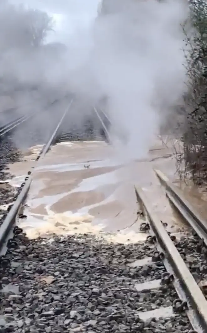
Network rail said: “It’s liquified mud that’s flowed onto the live rail and turning to steam. Once the mud has stopped flowing we will work on getting it cleared.”
People from across the UK woke up to snow falling, as temperatures dipped below freezing in much of the country.
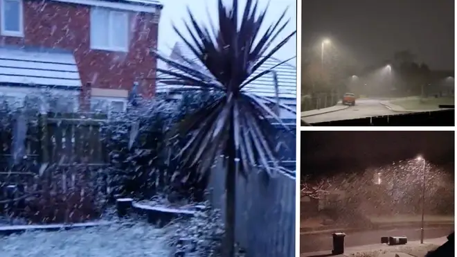
Videos shared in Dorset, Cumbria and the north-east show snow showers on Monday morning, as the mercury dropped to as low as -10C.
Temperatures are expected to drop to -2C in London on Monday night, -1C in Cardiff, -3C in Edinburgh and Belfast and -10C in parts of the Scottish highlands.
Meanwhile drivers were warned to leave extra time for their commute on Monday morning, with roads expected to be icy during rush hour, following a weekend of wintry weather.
A Met Office yellow warning for ice across the centre of the UK covers all four nations until 10am, when conditions are expected to improve in most areas apart from northern Scotland - where snow is forecast to continue.
#uksnow pic.twitter.com/Yxy63YVNTG
— Richard Traut (@richardtraut) January 16, 2023
The forecaster has said overnight sleet will leave behind slippery surfaces which could cause "injuries from slips and falls" and "icy patches on some untreated roads, pavements and cycle paths".
Heavy rain, which will turn to snow in places, is also due to affect the south-east coast, which was covered by a yellow warning until 8am on Monday.
@DorsetSnow got woken up by the bins blowing over and now I’ve seen it’s snowing I can’t sleep! Broadstone! #uksnow pic.twitter.com/LDrdaegwXo
— Stuart McAllister-Payne (@Stu_McAllister) January 16, 2023
Met Office meteorologist Craig Snell said the cold conditions moved in from the Arctic over the weekend.
He said: "We could well see some wintry showers develop tonight across the middle band of the UK, with a risk of snow on high ground and slippery surfaces on lower areas.
Wow 🤩 wasn’t expecting to wake up to this! #uksnow falling and settling in in Carlisle ❄️😃 pic.twitter.com/tLkxGjXS2g
— Liam James ⚡️ (@liam_lovell) January 16, 2023
"This could be a problem during rush hour, it could cause a few problems on the roads. The risk of flooding is still there."
Mr Snell said most of the nation will be dry with sunny spells through the rest of Monday.
#uksnow NE24 8/10 snowing on NE coast pic.twitter.com/vQ6kZWp8Mj
— Fiona H (@Dancingboots) January 16, 2023
The Met Office said: "Overnight frost will become more widespread by Monday night, with overnight temperatures below 0°C across much of the UK.
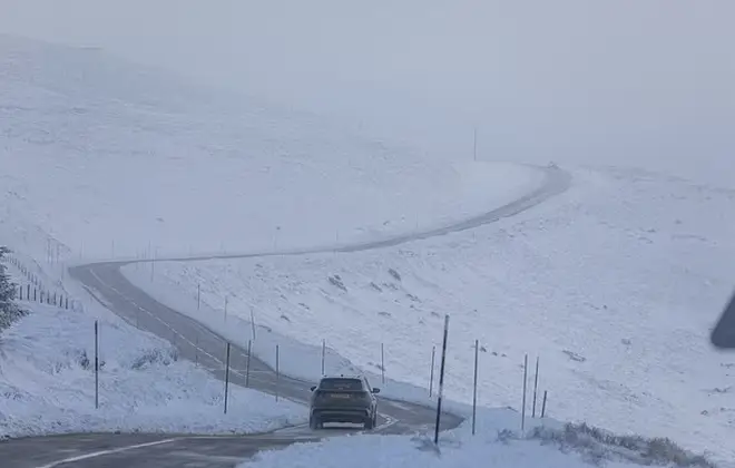
"Temperatures could get down to -10°C in sheltered glens, or across high ground areas of Scotland where there is lying snow."
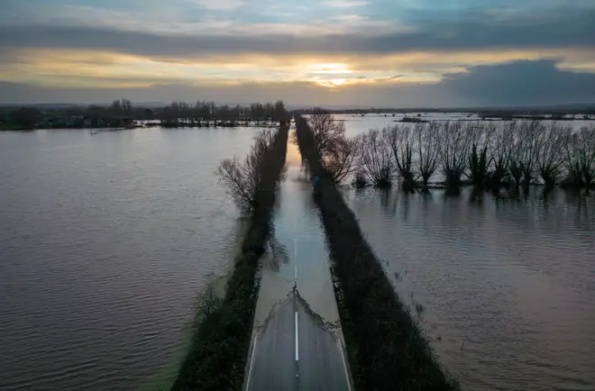
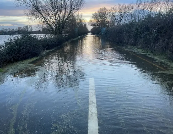
It comes as flooding hit much of the UK amid heavy rain over the past few days, including Somerset and York.
Sarah Cook, flood duty manager at the Environment Agency, has said workers will continue dealing with flooding in the areas which were worst hit by the weekend deluge on Monday.
Speaking on Sunday night, she said: "Recent heavy rainfall means river levels will remain high, so some minor flooding is still possible in small parts of south-west England, and the West Midlands into Monday.
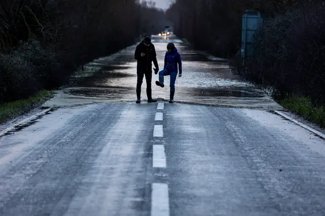
"We could see more rain tonight in the south of England too, giving the possibility of a minor risk of flooding to isolated properties.
"With the ground saturated, communities in these areas should check their flood risk.
Read more: Brits brace for snow in Scotland and south of England, with flood warnings still in place across UK after days of heavy rain
"The Environment Agency is monitoring flood levels, operating flood gates and barriers at locations across the country, and ensuring debris screens are clear from blockages to ensure communities are better protected."
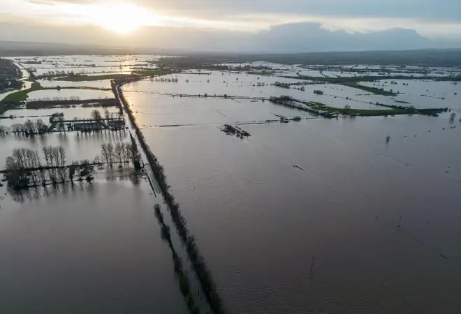
Ms Cook said people should stay away from swollen rivers and to avoid driving through flood water.

Nick Ferrari destroys a climate change protester
The Environment Agency has warned that people should expect more flooding due to the effects of man-made climate change.