
Tom Swarbrick 4pm - 7pm
11 August 2022, 17:33 | Updated: 12 August 2022, 16:22
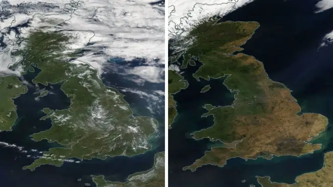
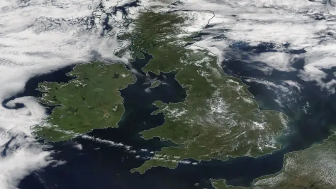
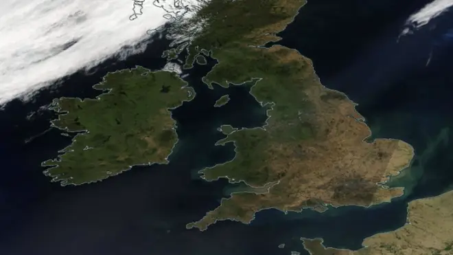
Satellite images have shown the scale of Britain's heatwave as it continues to bake in extreme temperatures.
The extent of the scorched landscape in the south of England was laid bare in the latest aerial images from NASA, which showed the country's previously green land appear as a yellow and black tinderbox.
It comes as a drought is expected to be declared for parts of southern England on Friday, LBC understands.
The UK's National Drought Group is set to meet in the morning to discuss prolonged dry weather and an announcement could be made early in the afternoon.
There has been warnings of an "exceptional risk" of wildfires that will threaten Britain on Friday, just weeks after flames tore through homes and farms.
Britain has entered the first of four days of a heatwave that one expert fears could be even worse for people's health than July's record breaking 40C heat – though temperatures are not set to climb that high.
Meanwhile, last month also marked the driest July since 1935.
The Met Office has an amber extreme heatwave warning in place for most of southern England, the Midlands and Wales until the end of Sunday, with the mercury possibly due to hit 36C in some parts.
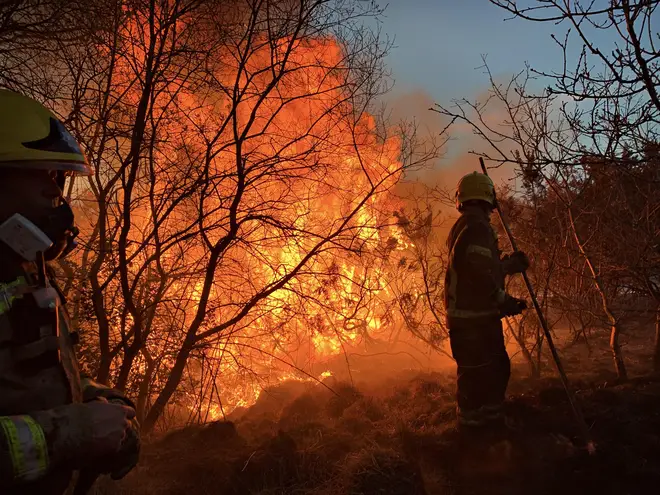
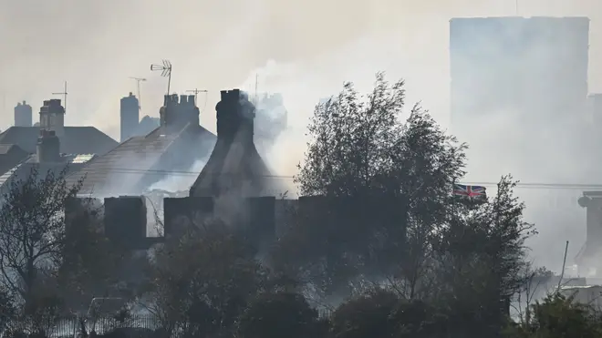
The last bout of serious heat saw wildfires break out across the country, engulfing chunks of Wennington in Essex that left homes and gardens devastated.
Motorways and skylines became shrouded by black smoke that emerged from a spate of fires that set off across England – and the risk of them breaking out again is back.
"The risk is very high across much of central, southern and eastern England," warned Marco Petagna, a Met Office meteorologist.
"Going into Friday and the weekend, it starts to increase further, going into the highest category of exceptional risk."
Extremely low water levels exposed as drought hits England
This heatwave could last longer than the 40C record-breaking wave last month – and prove to be even more dangerous for people's health.
The Met Office has issued amber warnings for extreme heat covering most of southern England, the Midlands and part of Wales from Thursday until the end of Sunday.
Although the mercury is not expected to climb as high as the 40s – possibly peaking at 36C - its longer duration could be more of a threat.
Read more: Victims of burglary being failed by police and 'not getting justice they deserve', watchdog says
Hannah Cloke, Professor of Hydrology at the University of Reading, said: "The warnings for extreme heat from both the Met Office and the heat health alert issued by the UK Health Security Agency are another reminder that this summer in the UK is proving to be lethally hot.
"Compared to the July record-breaking heat, this event will be less intense but last longer, which could actually have a greater impact on people's health.
"This heatwave might not break any records for maximum temperatures, but it might actually cause more deaths."
The Met Office has warned of "adverse health effects" for people more vulnerable to extreme heat, and warned of a general risk to people including sunburn or heat exhaustion.
Changes to work practices may be needed and the expected rise in trips to the coats, lakes and rivers will lead to an increased risk of water incidents.
"Some delays to road, rail and air travel are possible, with potential for welfare issues for those who experience prolonged delays," the Met Office said.
The weather agency said heat will build up until it peaks on Friday and Saturday due to high pressure over the UK.
🔶 Amber extreme heat warning issued 🔶
— Met Office (@metoffice) August 9, 2022
Extreme heat warning issued across parts of England and Wales
Thursday 0000 - Sunday 2359
Latest info 👉 https://t.co/QwDLMfRBfs
Stay #WeatherAware⚠️ pic.twitter.com/L3p9rFqxfk
But they are not set to get as high as the 40C highs seen in July on Britain's hottest ever day.
The Met Office's deputy chief meteorologist, Dan Rudman, said: "Thanks to persistent high pressure over the UK, temperatures will be rising day-on-day through this week and an Extreme heat warning has been issued.
"Temperatures are expected to peak at 35C on Friday and Saturday, or even an isolated 36C on Saturday. Elsewhere will see temperatures widely into the high 20s and low 30s Celsius.
"Coupled with the high daytime temperatures there will be some warm nights, with temperatures expected not to drop below the low 20s Celsius for some areas in the south."
Outside of the heatwave warning area, Scotland and Northern Ireland are also due to see temperatures in the high 20s and may enter a heatwave by Friday.