Ben Kentish 10pm - 1am
20 October 2022, 16:57

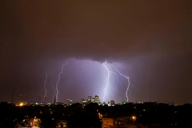
The Met Office put out a yellow weather warning for thunderstorms over parts of the UK today, as Brits were hit with flooding, hail and hard winds.
It covered areas of England from Newcastle down to Manchester and northern parts of London.
The warning was set to last until 1pm today, and carried with it a warning of disruption across the affected areas today, including travel and driving problems, potential flash flooding and damage to buildings and property.
Drivers were warned spray and sudden flooding could cause difficult driving conditions and some road closures, and that power cuts were possible and that other services to some homes and businesses could be affected.
Read more: Penny Mordaunt, Rishi Sunak or Boris Johnson: Who could replace Liz Truss?
Schools, museums and roads were shut in Bedford after the area has hit by flooding, with businesses and homes also affected.
Met Office meteorologist Alex Deakin said: “Low pressure is going to dominate things for the next 10 days, bringing spells of wet and windy weather and also some quite high temperatures.”
He added: “We’ve got this large area of low pressure. It’s a mature feature, which means it’s been around for a while.
"The reason it’s not shifting is because of the position of the jet stream, which is driving south through the Atlantic and creating a trough, allowing this low to mill around and driving up other weather fronts.
“Fast forward to Monday and the pressure hasn’t really changed very much. The low has shifted a little bit further north.
The latest radar sequence shows bands of heavy and thundery rain moving northwards across parts of southern and central England this morning
— Met Office (@metoffice) October 20, 2022
Some local surface water flooding is possible with difficult travelling conditions expected, so please allow extra time for your journeys pic.twitter.com/1PnX9jW3rI
"There’s another one spawning out in the Atlantic and the jet stream hasn’t really shifted either.
"So that means bands of showery rain over the next five days, with the isobars often squeezing together, bringing spells of gusty winds.”
This is the outlook for the coming days:
Thursday
Rather cloudy across much of Scotland and large parts of England. Spells of rain here, heavy at times, with parts of northern and eastern England seeing the most persistent rain.
Brighter over Northern Ireland, Wales and south-west England.
Thursday night
Early evening rain over northern and eastern England and Scotland becoming mainly confined to northern Scotland later.
Becoming windy and showery in the southwest. Some fog patches developing.
Friday
Cloudy with rain at times over northern Scotland. Most other areas windy and showery, showers heavy at times, but some bright or sunny spells between showers too.
Saturday to Monday
Continuing unsettled with periods of rain or showers, heavy at times, but some drier and brighter interludes too.
Windy in places, especially in the south on Monday. Warm for October.