Nick Ferrari 7am - 10am
5 September 2023, 11:53 | Updated: 5 September 2023, 14:09

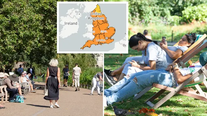
An amber alert for high temperatures has been issued as the UK faces a September mini heatwave that could break records.
Forecasters are predicting the late summer heat could even break the UK record for the hottest day of the year - which currently stands at 32.2C in June.
A yellow heat warning that was issued for most of England was upgraded to an amber alert today - as temperatures are set to soar to 32C - or hotter than Thailand.
The heat-health alert is in place from midday on Tuesday until 9pm on Sunday.
The regions included in the amber alert are London, the South-East, South-West, North-West, East Midlands, West Midlands, east of England, and Yorkshire and the Humber.
The amber alert warns of ‘significant impacts’ on the NHS and says an increased mortality rate is likely - especially among the elderly and vulnerable.
Heatwave criteria is also likely be met in a number of places over the next couple of days, and for much of the UK it will feel "very warm to hot", senior meteorologist Rachel Ayers said.
Wondering what the weather has in store for the week ahead?
— Met Office (@metoffice) September 4, 2023
Here’s Alex with all the details 👇 pic.twitter.com/W7LiOKiQED
"On Tuesday, there will be some patchy cloud for the far southwest and later Northern Ireland with a risk of the odd shower/isolated thunderstorm," Ms Ayers said.
"Elsewhere after any low cloud, mist and fog lifts and clears it will be dry with plenty of sunshine.
"It will be cloudier in the far north of Scotland with the odd spot of rain and drizzle, though drier than recent days.
"Temperatures will vary between 27 to 30C in central and southern areas, with an isolated 31C possible inland.
"On Wednesday, mist and fog will clear once again with low cloud burning back to the coast through the morning, again leaving a very warm or hot day.
"Again some patchy cloud in the far west and Northern Ireland. A chance of showers moving into the South West during the evening, risk of an isolated thunderstorm. Temperatures will climb to 32C in central and south-east England.
"Thursday, another fine day after early mist and fog clears. Again cloudier for North Sea coasts, and inland at first, but cloud burning back to the coasts.
"Sunshine will be more hazy in the west than previous days. Overnight showers will push north in the west with some outbreaks of rain in the far north west of Scotland.
"Temperatures will climb to 32C in central and south-east England."
A settled week of weather to come for most, with temperatures generally climbing day-on-day, peaking on Wednesday or Thursday 📈 pic.twitter.com/1Cd50rZhuH
— Met Office (@metoffice) September 4, 2023
She continued: "On Friday, most places will remain fine and dry with sunny spells. Areas of cloud will limit sunshine in places, with a small chance of an isolated shower or thunderstorm, predominantly in the west.
"Patchy rain is likely, at least for a time in the far north west, perhaps with brighter, drier, fresher conditions here later. Mainly light winds, though winds increasing in the north west.
"Continuing very warm or hot for many and likely feeling humid, but with low cloud and lower temperatures around some coasts, with the potential for cooler air to move into some northern parts too.
"Temperatures climbing to 31C in central and south-east England."
🌡️ In addition to high daytime temperatures through this week, it will remain uncomfortably warm overnight
— Met Office (@metoffice) September 4, 2023
There is a chance of some tropical nights, especially in the south, which is when overnight temperatures remain in excess of 20°C pic.twitter.com/GRIfXbEzky
The evenings are also expected to remain very warm with temperatures potentially not dropping below 20C on Wednesday - meaning a "tropical night" is on the cards.
Another tropical night is forecast on Thursday as temperatures remain above 20C.
It is the tropical storms in the Atlantic that have led to high pressure "dominating over the UK", the Met Office said.
Meanwhile, the weekend is set to become cooler, turning unsettled next week when the weather will return to September's average temperatures.
Other forecasts suggest the warmer conditions could stay around until October.
It comes after a summer of mostly cloudy and showery weather, with July in particular being wetter and cooler than average.