Clare Foges 6pm - 9pm
16 August 2022, 15:16 | Updated: 17 August 2022, 07:40

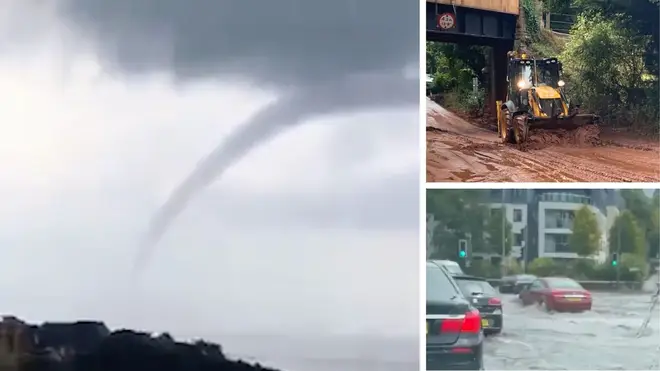
Waterspout seen in the cloudy skies over Cornwall
A waterspout tornado has hit Cornwall as torrential downpours and huge mudslides take over parts of the UK after days of scorching heat.
The "jaw-dropping" tornado was seen by passengers on a ferry in the area, with it "touching water in the mouth of Fowey estuary".
It comes as roads in Cornwall and Devon flooded in the early hours of Tuesday as heavy rain and thunderstorms hit parts of the UK for the second day running.

Meanwhile, local authorities in Somerset said more than 50 tonnes of mud - as well as sand and potatoes - had to be shifted off the A358 after a huge mudslide at Combe Florey.
The major A-road was closed down following the incident on Monday evening but reopened just after 3pm on Tuesday.
A big thank you too Irene E Beale for sending this in.
— Kernow Weather Team (@KWTWeather) August 16, 2022
Kind regards
KWT Dave@piratefm @BBCCornwall @BBCSpotlight @metoffice @bbcweather @ITVCharlieP @itvwestcountry pic.twitter.com/4FnhdwML6g
The Met Office has issued several thunderstorm warnings for across the UK until the end of Wednesday, with the Environment Agency putting out 19 flood alerts in areas of the Midlands and south-east England.
It comes amid an abrupt end to the heatwave last week and follows weeks of little rain, which has left land parched.
Read more: 'Pack an emergency bag': Brits warned to prepare for flash floods as thunderstorms set to batter UK
Read more: Flash flooding and torrential rain sweeps into the UK as record breaking heatwave is washed away

Brits in flood-prone areas were earlier told to prepare an emergency bag - containing mobile phones, a battery-powered charger in case power is interrupted, a torch and important information such as insurance documents - ahead of the downpours.
It comes despite droughts still being announced across the country, the latest being in Yorkshire.


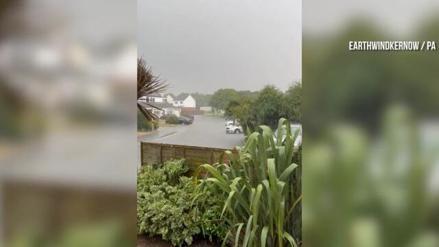
Newquay suffers flash flooding as rain follows heatwave
It follows parts of the South West, southern and central England and the east of England all being moved to official drought status.
Experts said heavy rainfall runs off very dry land, creating surface water floods, and will not soak into the ground to relieve drought-hit areas.
Showers and #thunderstorms will become more extensive over the next 2 or 3 hours with some locations experiencing slow-moving torrential downpours
— Met Office - E England (@metofficeEEng) August 16, 2022
Heavy downpours may cause flooding and travel disruption
⚠️Yellow thunderstorm warning in force - https://t.co/62GHUT90cV pic.twitter.com/qgULVduC2h
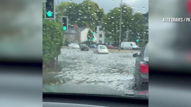
Footage and photos shared to social media show torrential showers and flooding on roads in Cornwall and Devon.
One Twitter user shared a video of floodwater in Newquay, writing: "I've never seen rain like this. Our road is flooding #Newquay."
Another user in Bishop's Tawton, north Devon, tweeted: "[F]lash flooding causing use of sandbags to prevent water in house, despite recent flood work by @EnvAgency urgent need for solutions."

Met Office spokesman Stephen Dixon said: "We have got thundery showers possibly for a lot of peoples of the UK today.
"Within the warning area, it is important to note that thunderstorms could pop up anywhere. That being said, some areas could miss the rain altogether."

Truro in Cornwall flooded as heavy rain follows heatwave
Mr Dixon said parts of the country could see up to 50mm of rain within three hours.
He said storms likely to appear in areas of the Midlands could be "slow moving", adding: "That risk of thunderstorms will move to southern areas of the UK as the day goes on."
Mr Dixon said this risk will continue overnight and throughout Wednesday.
"Early on Thursday morning, the main risk that we are looking at is for the South East," he said.
"The risk then decreases as the day goes on."