Nick Ferrari 7am - 10am
28 November 2023, 10:38 | Updated: 28 November 2023, 10:42

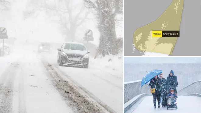
The Met Office has issued fresh weather warnings for snow and ice, which will hit the UK later today.
According to the national forecaster, snow will hit the UK this evening.
The first yellow weather warning will run from 5pm this evening until 11am on Wednesday.
Another yellow weather warning will then come into effect at 5pm on Wednesday, lasting until 11am on Thursday.
⚠️ Yellow weather warning issued ⚠️
— Met Office (@metoffice) November 28, 2023
Snow and ice across parts of Scotland and northeast England
Tuesday 1700 – Wednesday 1100
Latest info 👉 https://t.co/QwDLMfRBfs
Stay #WeatherAware⚠️ pic.twitter.com/5HcTlMeHGC
What can you expect from a yellow weather warning for snow and ice?
According to the Met Office:
Read More: Snow alert issued as 11 areas to be hit by freezing temperatures - will your area be affected?
Read More: Will it be a White Christmas? Met Office gives verdict as snow set to fall 'in days'
David Oliver, a Met Office deputy chief meteorologist, explains: “After some rain on Monday, conditions will turn mainly dry in the south for a time before a very uncertain period on Thursday and Friday for the southern half of England and Wales.
"The weather models are highlighting several possible solutions from very wet to mainly dry, with a mainly dry picture the most probable outcome at present.
"However, some models include the prospect of an area of low pressure developing and moving in from the south or southwest."

He continued: "If this solution proves to be correct, we could see an area of warmer and moisture-laden air ‘bumping’ into the cold air further north.
"Along the boundary of the two air masses lies a zone across southern and central Britain where snowfall could develop fairly widely.
"Snow in any affected area is unlikely to be anything more than transient and short-lived, but it could lead to small totals and some disruption over a few hours before melting."
Central Scotland
Tayside
Fife
Grampian
Highlands
Eilean Siar
Orkney
Shetland
south-west Scotland
Lothian, Borders
north-east England and Yorkshire Humber