James O'Brien 10am - 1pm
4 January 2024, 10:33

Next week the UK will be hit by freezing fog and colder temperatures, as flooding in the aftermath of Storm Henk is still causing disruption.
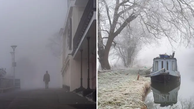
Temperatures are expected to drop, which will see freezing fog hit parts of the UK in the middle of the week.
The Met Office's forecast for January 8-17 reads: "By the middle of next week, the wind should ease and, with high pressure in charge, there should be a good deal of dry weather.
"Cloud amounts will continue to be quite variable, but all areas should see some sunshine at times.
"Much colder than recently, with frost probably becoming quite widespread and some freezing fog patches are possible in places.
"Beyond next week, conditions are likely to remain cold, with an increasing chance of some wintry showers, particularly in the north."
Freezing fog forms in winter when there are clear skies and calm conditions.
Read more: Hero of Storm Henk: Man risks life to save three-year-old and driver trapped in sinking car
The Met Office says: "When fog forms in temperatures that are below freezing, the tiny water droplets in the air remain as liquid."
"This occurs because liquid needs a surface to freeze upon. When droplets from freezing fog freeze onto surfaces, a white deposit of feathery ice crystals is formed.
"This is referred to as rime; rime is a characteristic of freezing fog and is often seen on vertical surfaces exposed to the wind.
The UK will face rain and light winds for the rest of this week.
There is a yellow weather warning in place for rain across the south of England until early Friday morning.
⚠️ Yellow weather warning issued ⚠️
— Met Office (@metoffice) January 3, 2024
Heavy rain across the south of England
Thursday 1200 – Friday 0300
Latest info 👉 https://t.co/QwDLMfRBfs
Stay #WeatherAware⚠️ pic.twitter.com/OKjV0LVPhr
The Met Office predicts flooding could lead to difficult driving conditions and road closures in some places.
Some homes and businesses could see power cuts.
Train and bus services may be disrupted because of flooding.
The Met Office warned: "Another spell of rain falling onto saturated ground, may lead to further flooding and travel disruption."
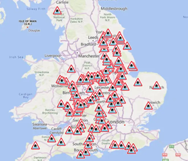
In the aftermath of Storm Henk, there are 239 flood warnings are in place across England, 1 severe flood warning in Wales, and 2 flood warnings in Scotland.

The Environment Agency warned: "Properties could flood and there could be travel disruption. Ongoing local flooding is probable from rivers and surface water widely across England today. Some river flooding may continue throughout the next five days.
"Land, roads and some properties could flood and there could be travel disruption. Local groundwater flooding is possible in parts of the South of England, Yorkshire and the Humber throughout the next five days. Land, roads and some properties may flood and there may be travel disruption."
The rest of the week will see forecasts of rain and light winds.
The forecast for January 4-5 from the Met Office says: "A spell of heavy rain will track eastwards across southern parts of England through the day. Rain at times in Scotland, drier elsewhere with some bright or sunny spells. Light winds with temperatures near to average.
"Rain clearing the east. Mostly dry with some coastal showers. Light winds and some clear skies lead to patchy frost and fog forming through the early hours.
"A few showers on Friday, these mainly in coastal areas. Otherwise a mainly dry day. Rather cloudy, but some bright or sunny spells developing. Feeling a little cooler."