Ali Miraj 12pm - 3pm
14 August 2022, 17:29 | Updated: 15 August 2022, 08:03

Incoming rain will merely "scratch the surface" of Britain's drought problem despite thunderstorm and heavy warnings issued by the Met Office.
John Hammond, a forecaster at WeatherTrending, said that while "every drop counts" many parts of the country will not get enough.
And a longer-term outlook for the weather includes the possibility of heatwave conditions returning.
Mr Hammond told LBC's Nick Ferrari at Breakfast: "We are going to go, kind of, from one extreme to another.
"There is going to be some rain, for some of us too much in a very short space of time, for others just not enough.
"We're in a deficit of hundreds of millimetres of rain, some places have not seen even 50% of normal rainfall that we'd expect at this stage of the year.

A few days of rain won't 'scratch the surface' of the drought
"In the next few days some places will pick up ten or 20mm of rain, that is a spit, a drop in the ocean, a scratch on the surface of this drought.
"But every drop counts doesn't it."
He said that because the ground is dry, rain won't seep through and it will instead run off, creating the possibility of flash flooding.
Looking 10 days ahead, after this week of rain, "heatwave conditions" could return, he added.
The Met Office has issued weather warnings for thunderstorms and heavy rain after the UK sweltered in 33C heat over the weekend.
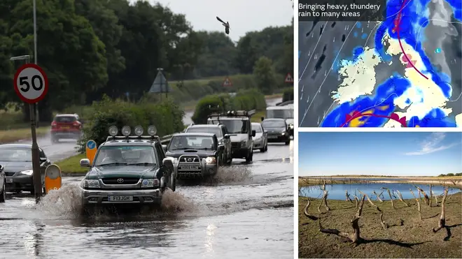
Parts of the UK are bracing for three days of yellow weather warnings for thunderstorms sparking fears of flooding amid the drought.
In Scotland and Northern Ireland, a yellow warning for thunderstorms is in place from 9am Sunday to 11.59pm Monday as the north experiences a sweep of heavy rain for the next two days.
The forecaster has warned of flash flooding and power cuts as showers beat down across the two regions.
The warning then spreads to England and Wales on Monday and Tuesday, with just the south west and south east of England facing a third day of yellow warnings on Wednesday until 11.59pm, as the rain eases off elsewhere.
The warnings highlight the chance of some places seeing around 50mm of rain falling in a three-hour period in the north, with some areas further south possibly seeing around 30mm of rain in a three-hour period.
Hail and frequent lightning are also possible as part of these downpours.
⚠️ Yellow weather warning issued ⚠️
— Met Office (@metoffice) August 14, 2022
Thunderstorms across Orkney
Today 1700 until 2200
Latest info 👉 https://t.co/QwDLMfRBfs
Stay #WeatherAware⚠️ pic.twitter.com/jXLnORKOxL
Dan Stroud, a meteorologist at the Met Office, said the drastic change in weather is due to an alteration in the air pressure.
He said: "We've had a number of days now where we've had clear, strong, clear skies and strong sunshine which has heated up the ground.
"We've had high pressure dominating, now we're having low pressure dominate, so the air is becoming more unstable. As we've had some very high ground temperatures, it doesn't actually take too much for the air to become even more unstable and for thundery showers to develop quickly."
An official drought was declared in eight areas of England on Friday by the National Drought Group (NDG), which comprises representatives from the Government, water companies, the Environment Agency (EA) and others.
Read more: Dog show slammed for going ahead during 35C heatwave despite RSPCA health warning
Three water companies - Welsh Water, Southern Water, and South East Water - have all imposed hosepipe bans, while Yorkshire Water has announced a ban will start on August 26 and Thames Water is planning one in the coming weeks.
Mr Stroud said that despite the forecast of intense showers over the next few days, it is unlikely to help the drought.
"It will help a little but to be honest really, it's almost the wrong sort of rain," he said.
"What we're likely to see is some heavy, intense downpours. With the ground baked so dry, it's very difficult for the ground to actually absorb the water very quickly.
"So what tends to happen in these circumstances is the water runs off and we can potentially get some surface run-off issues, so some flash floods."
Our weather and temperatures are set to change over the next few days, becoming cooler and more unsettled...
— Met Office (@metoffice) August 14, 2022
...here is why 👇 pic.twitter.com/PvYxyjQ0Mf
An amber weather warning for extreme heat is still in place until 11.59pm on Sunday for large parts of the south, east, west, midlands and north of England as temperatures are predicted to rise to 32C.
The Met Office has put the warning in place saying that people could experience "adverse health effects", such as sunburn or heat exhaustion, and delays to transport during the hot weather.
Lincolnshire Police confirmed a teenage boy died on Saturday after getting into the sea at Skegness after temperatures reached more than 30C in some parts of England.
It came after a body was found in a Doncaster lake earlier that day following reports that a man in his 20s had got into difficulty in the water.